Browse / United States / California / Chula Vista
Chula Vista
Californiacity

Chula Vista
Total population
278,548
Median home value
$839,000
Bachelor's+
Median income
$105,101
Founded
1911
Demographic figures from US Census Bureau · ACS 5-year estimates. Overview below cites Wikipedia and may reference a different year.
- Heat Advisory · ModerateHeat Advisory issued October 15 at 1:39PM PDT until October 17 at 8:00PM PDT by NWS San Diego CA
Source: NOAA National Weather Service.
City facts
Facts from Wikidata (CC0).
Overview
Chula Vista is a city in San Diego County, California, United States. It is the second-most populous city in the San Diego metropolitan area, the seventh-most populous city in Southern California, the 15th-most populous city in the state of California, and the 81st-most populous city in the United States. The population was 275,487 as of the 2020 census, up from 243,916 as of the 2010 census. It is located in the South Bay, about halfway—7.5 miles (12.1 km)—between the two downtowns of the San Diego–Tijuana region. Chula Vista is named for its scenic location between San Diego Bay and coastal mountain foothills.
Read more on WikipediaHistory & geography
History
Fossils of aquatic life, in the form of a belemnitida from the Jurassic, have been found within the modern borders of Chula Vista. although Eocene epoch fossils have been found in nearby Bonita. The oldest site of human settlement within the modern boundaries of Chula Vista, was named Otai by the Spanish in 1769, and had been occupied as far back as 7,980 years ago. In 3000 BC, people speaking the Yuman (Quechan) language began moving into the region from the Lower Colorado River Valley and southwestern Arizona portions of the Sonoran Desert. Later the Kumeyaay tribe came to populate the land, on which the city sits today, and lived in the area for hundreds of years. In 1542 AD, a fleet of three Spanish Empire ships commanded by Juan Rodríguez Cabrillo, sailed into San Diego Harbor. Early explorations by Spanish conquistadors, such as these, led to Spanish claims of the land. The village of Chiap (known to the Spanish as La Punta) became a center of a Kumeyaay revolt against the Spanish in 1775, which was later abandoned by 1776. The historic land on which Chula Vista sits became part of the 1795 land grant known as Rancho del Rey or The King's Ranch. The land eventually was renamed Rancho de la Nación. its construction was under the command of Captain George F. Price of the 5th Cavalry Regiment out of Camp McDowell. In the 1870s and 1880s mining was done on Rancho Janal. The San Diego Land and Town Company developed lands of the Rancho de la Nación for new settlement. The town began as a five thousand acre development, with the first house being erected in 1887; by 1889, ten houses had been completed. Around this time, the lemon was introduced to the city, by a retired professor from the University of Wisconsin. Chula Vista can be roughly translated from Spanish as…
Geography
Owning up to its Spanish name origins—beautiful view—Chula Vista is located in the South Bay region of San Diego County, between the foothills of the Jamul and San Ysidro Mountains (including Lower Otay Reservoir) and San Diego Bay on its east and west extremes, and the Sweetwater River and Otay River at its north and south extremes. The geography of Chula Vista is impacted by the La Nacion and Rose Canyon Fault zones; it has moved rocks from Pleistocene and younger eras. Yet, as late as 13,000 years ago, soils in the Rancho del Rey area have been unaffected by fault activity. Chula Vista is the second largest city, by area, within San Diego County. According to the United States Census Bureau, the city covers an area of , of it land, and or 4.73% of it water. Chula Vista has within its city limits the Sweetwater Marsh unit of the San Diego Bay NWR. It also maintains several city maintained open space areas. The original Chula Vista encompasses the area west of Hilltop Drive and north of L Street. Beginning in the late 1980s the planned communities of Eastlake, Otay Ranch, Millenia, and Rancho del Rey began to develop in the annexed areas east of Interstate 805 and California State Route 125. These communities expanded upon the eastern annexations of the 1970s, including the area around Southwestern College. In 1989, Rancho del Rey was established. In 1999, Otay Ranch began to be built on . Although "Eastlake" properly refers only to one planned community in east Chula Vista built around an artificial pond, the name is often used to encompass a much broader suburban region along the SR 125 corridor. This is in part due to the misconception that the lake which the name "Eastlake" refers to is the much larger Lower Otay Reservoir. Many businesses and institutions…
Excerpted from the corresponding Wikipedia article (CC BY-SA).
Demographics & economy
Race & ethnicity
Source: US Census Bureau — American Community Survey, 5-year estimates.
Geography
Coordinates & boundaries from the US Census TIGER/Line shapefiles.
Climate
Current forecast
Forecast for Chula Vista, CA from NOAA NWS API.
Air quality
Industrial & pollution facilities
Natural hazard risk
Health (adults)
Age-adjusted prevalence estimates from CDC PLACES (latest release).
Walkability
Amenities nearby
Wildlife & biodiversity
Schools
Largest nearby schools
- Eastlake HighHigh · Chula Vista · 2,783 students · 25.3:1 ratio
- Sweetwater HighHigh · National City · 2,679 students · 24.8:1 ratio
- Helix HighHigh · La Mesa · 2,502 students · 24.3:1 ratio
- Otay Ranch Senior HighHigh · Chula Vista · 2,491 students · 24.7:1 ratio
- Olympian HighHigh · Chula Vista · 2,341 students · 24.6:1 ratio
- San Diego Workforce Innovation HighHigh · National City · 2,332 students · 24:1 ratio
- San Ysidro HighHigh · San Diego · 2,316 students · 23.9:1 ratio
- Steele Canyon HighHigh · Spring Valley · 2,168 students · 25.5:1 ratio
Public K–12 schools within ~10 mi from Urban Institute Education Data Portal (NCES Common Core of Data, 2022).
Earthquake history
Photos
Sights & places nearby
Notable people from here


People born within ~10 km, from Wikidata (CC0). Click any name for their Wikipedia article.
Nearby places in California
- Bonita3.2 mi away · pop. 12,652
- Jamul10.5 mi away · pop. 6,574
- Bostonia13.9 mi away · pop. 16,765
- Potrero23.8 mi away · pop. 417
- Poway24.9 mi away · pop. 48,713
- Del Mar27.2 mi away · pop. 3,903
- Descanso28 mi away · pop. 1,590
- Rancho Santa Fe29.5 mi away · pop. 2,260
- Harmony Grove33.5 mi away · pop. 2,585
- Fallbrook52.9 mi away · pop. 32,112
- Rainbow54.5 mi away · pop. 2,029
- Borrego Springs57 mi away · pop. 2,700
Geography & sun
Elevation, sunrise/sunset and daylight from Open-Meteo. Solar climatology from NASA POWER.
Nearby airports
Public attention
Pageview totals from the Wikimedia Pageviews API.
Books about Chula Vista
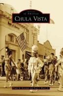
Search results from Open Library.
Recent natural events nearby
- Wildfire RIDGE, Los Angeles, CaliforniaWildfires · 2026-08-07 · 182 mi
- Wildfire BUZZARD, Kern, CaliforniaWildfires · 2026-08-05 · 191 mi
Wildfires, storms and other events from NASA EONET (last 12 months, within 250 mi).
Ground air-quality sensors
Recently spotted species
Nearest stream gauge
Live readings from USGS NWIS · measured 2026-10-01 16:45 UTC.
Events
Gallery
Sources
- • Wikipedia
- • US Census Bureau (ACS 5-year estimates)
- • NOAA National Weather Service
- • Wikidata
- • USGS NWIS (water data)
- • NCES via Urban Institute Education Data Portal
- • CDC PLACES
- • Open-Meteo / sunrise-sunset.org
- • Wikipedia Pageviews API
- • Open Library
- • NASA EONET