Browse / United States / California / Oasis
Oasis
CaliforniaCDP
Total population
4,051
Median home value
$34,800
Bachelor's+
Median income
$38,769
Air quality index
Demographic figures from US Census Bureau · ACS 5-year estimates. Overview below cites Wikipedia and may reference a different year.
City facts
Overview
Oasis, a census-designated community in California, United States, forms part of the country's settled landscape. Its coordinates of 33.528°, -116.126° place it in the warm-temperate zone of the northern hemisphere. Census-style estimates put the resident count near 4,051. Population density therefore averages about 80 per km², a sparse settlement pattern. Climatically, locations at this latitude tend to experience warm summers and cool winters. The administrative footprint covers roughly 50.9 km². The location receives about 2,125 kWh/m² of solar irradiance per year and sunshine for roughly 83% of daylight hours. Further detail — demographics, climate, nearby amenities and natural-hazard data — is compiled below from public open-data sources.
Summary composed automatically from structured open data on this page. See our Terms for details.
History & geography
Demographics & economy
Race & ethnicity
Source: US Census Bureau — American Community Survey, 5-year estimates.
Geography
Coordinates & boundaries from the US Census TIGER/Line shapefiles.
Climate
Air quality
Current readings from Open-Meteo Air Quality API (Copernicus CAMS European reanalysis).
Industrial & pollution facilities
Natural hazard risk
Health (adults)
Walkability
Amenities nearby
Wildlife & biodiversity
Most-observed species
- Black PhoebeSayornis nigricans (Swainson, 1827) · Aves4,413
- VerdinAuriparus flaviceps (Sundevall, 1850) · Aves4,084
- Northern MockingbirdMimus polyglottos (Linnaeus, 1758) · Aves3,981
- American CootFulica americana Gmelin, 1789 · Aves3,845
- House FinchHaemorhous mexicanus (P.L.Statius Müller, 1776) · Aves3,599
- Common RavenCorvus corax Linnaeus, 1758 · Aves3,298
- Mourning DoveZenaida macroura (Linnaeus, 1758) · Aves3,275
- Black-necked StiltHimantopus mexicanus (P.L.S.Müller, 1776) · Aves3,054
Citizen-science & research observations from the Global Biodiversity Information Facility (GBIF).
Schools
Earthquake history
Most recent
- M 3.08 — 2026-10-0120 km ESE of Anza, CA
- M 2.63 — 2026-09-239 km WNW of Anza, CA
- M 2.91 — 2026-08-3122 km SSW of La Quinta, CA
- M 3.06 — 2026-08-2512 km WSW of Salton City, CA
- M 3.64 — 2026-08-1914 km N of Warner Springs, CA
- M 2.63 — 2026-08-1328 km SSW of Ocotillo Wells, CA
Events from the USGS Earthquake Catalog (global) (FDSN Event Web Service).
Photos
Sights & places nearby
Notable people from here
Nearby places in California
- Palm Desert20 mi away · pop. 51,163
- Indio Hills22.8 mi away · pop. 1,117
- Borrego Springs23.9 mi away · pop. 2,700
- Cathedral City28.8 mi away · pop. 52,267
- Idyllwild-Pine Cove37.9 mi away
- Desert Hot Springs38.1 mi away · pop. 33,200
- Sage45.4 mi away
- Cabazon46.2 mi away · pop. 1,887
- East Hemet48.9 mi away
- Banning53 mi away · pop. 31,093
- Descanso53.9 mi away · pop. 1,590
- Homestead Valley54.1 mi away
Geography & sun
Elevation, sunrise/sunset and daylight from Open-Meteo. Solar climatology from NASA POWER.
Nearby airports
Public attention
Pageview totals from the Wikimedia Pageviews API.
Books about Oasis

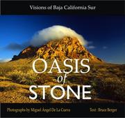

Search results from Open Library.
Recent natural events nearby
Ground air-quality sensors
Recently spotted species
Nearest stream gauge
Events
Gallery
Sources
- • US Census Bureau (ACS 5-year estimates)
- • Open-Meteo Air Quality (CAMS)
- • USGS Earthquake Catalog (global feed)
- • GBIF (Global Biodiversity Information Facility)
- • Open-Meteo / sunrise-sunset.org
- • Wikipedia Pageviews API
- • Open Library