Browse / United States / California / San Diego
San Diego
Californiacity

San Diego
Total population
1,404,461
Median home value
$980,700
Bachelor's+
Median income
$111,032
Air quality index
Demographic figures from US Census Bureau · ACS 5-year estimates. Overview below cites Wikipedia and may reference a different year.
- Beach Hazards Statement · ModerateBeach Hazards Statement issued October 5 at 1:33PM PDT until October 9 at 11:00PM PDT by NWS San Diego CA
- Coastal Flood Advisory · MinorCoastal Flood Advisory issued October 5 at 1:33PM PDT until October 9 at 11:00AM PDT by NWS San Diego CA
- Extreme Heat Warning · SevereExtreme Heat Warning issued October 5 at 11:29AM PDT until October 8 at 8:00PM PDT by NWS San Diego CA
Source: NOAA National Weather Service.
City facts
Overview
San Diego is a city on the Pacific coast of Southern California, next to the Mexican border. It is the eighth-most populous city in the U.S. and second-most populous city in California with a population of over 1.4 million, while the San Diego area with over 3.3 million residents is the 18th-largest metropolitan area in the country. San Diego is the county seat of San Diego County. It is known for its mild Mediterranean climate, extensive beaches and parks, long association with the United States Navy, and recent emergence as a Wireless, electronics, healthcare, and biotechnology development center.
Read more on WikipediaHistory & geography
Demographics & economy
Race & ethnicity
Source: US Census Bureau — American Community Survey, 5-year estimates.
Geography
Coordinates & boundaries from the US Census TIGER/Line shapefiles.
Climate
10-year averages from ERA5 reanalysis (Open-Meteo).
Current forecast
Forecast for San Diego, CA from NOAA NWS API.
Air quality
Current readings from Open-Meteo Air Quality API (Copernicus CAMS European reanalysis).
Industrial & pollution facilities
Natural hazard risk
Health (adults)
Age-adjusted prevalence estimates from CDC PLACES (latest release).
Walkability
Amenities nearby
Wildlife & biodiversity
Most-observed species
- House FinchHaemorhous mexicanus (P.L.Statius Müller, 1776) · Aves93,493
- American CrowCorvus brachyrhynchos C.L.Brehm, 1822 · Aves92,240
- Anna's HummingbirdCalypte anna (R.Lesson, 1829) · Aves81,824
- Black PhoebeSayornis nigricans (Swainson, 1827) · Aves76,793
- Western GullLarus occidentalis Audubon, 1839 · Aves65,655
- Song SparrowMelospiza melodia (A.Wilson, 1810) · Aves64,147
- Mourning DoveZenaida macroura (Linnaeus, 1758) · Aves62,507
- California TowheeMelozone crissalis (Vigors, 1839) · Aves59,033
Citizen-science & research observations from the Global Biodiversity Information Facility (GBIF).
Schools
Largest nearby schools
- Henry HighHigh · San Diego · 2,607 students · 27.2:1 ratio
- Helix HighHigh · La Mesa · 2,502 students · 24.3:1 ratio
- San Diego Workforce Innovation HighHigh · National City · 2,332 students · 24:1 ratio
- Hoover HighHigh · San Diego · 2,265 students · 23.1:1 ratio
- Mira Mesa HighHigh · San Diego · 2,219 students · 25.2:1 ratio
- Grossmont HighHigh · La Mesa · 2,175 students · 24.4:1 ratio
- San Diego HighHigh · San Diego · 2,105 students · 20:1 ratio
- Scripps Ranch HighHigh · San Diego · 1,984 students · 28.3:1 ratio
Public K–12 schools within ~10 mi from Urban Institute Education Data Portal (NCES Common Core of Data, 2022).
Earthquake history
Most recent
- M 2.99 — 2026-05-289 km WNW of Primo Tapia, B.C., MX
- M 2.65 — 2026-05-1620 km SW of Ocotillo Wells, CA
- M 2.51 — 2026-05-123 km WSW of Lake Henshaw, CA
- M 2.97 — 2026-04-0613 km N of Tecate, B.C., MX
- M 2.98 — 2026-04-0335 km W of El Sauzal, B.C., MX
- M 2.82 — 2026-03-303 km WSW of Lake Henshaw, CA
Events from the USGS Earthquake Catalog (global) (FDSN Event Web Service).
Photos
Sights & places nearby
Notable people from here


People born within ~10 km, from Wikidata (CC0). Click any name for their Wikipedia article.
Nearby places in California
- Bostonia11.2 mi away · pop. 16,765
- Bonita12.4 mi away · pop. 12,652
- Del Mar12.6 mi away
- Poway13.6 mi away · pop. 48,713
- Rancho Santa Fe15 mi away
- Jamul16.8 mi away · pop. 6,574
- Harmony Grove19.7 mi away · pop. 2,585
- Descanso29.7 mi away · pop. 1,590
- Potrero33.8 mi away
- Fallbrook39 mi away · pop. 32,112
- Rainbow41.1 mi away
- Borrego Springs53.8 mi away · pop. 2,700
Geography & sun
Elevation, sunrise/sunset and daylight from Open-Meteo. Solar climatology from NASA POWER.
Nearby airports
Public attention
Pageview totals from the Wikimedia Pageviews API.
Books about San Diego



Search results from Open Library.
Recent natural events nearby
- Wildfire RIDGE, Los Angeles, CaliforniaWildfires · 2026-08-07 · 168 mi
- Wildfire BUZZARD, Kern, CaliforniaWildfires · 2026-08-05 · 177 mi
- Wildfire PLAINS, San Luis Obispo, CaliforniaWildfires · 2026-08-12 · 243 mi
Wildfires, storms and other events from NASA EONET (last 12 months, within 250 mi).
Ground air-quality sensors
Recently spotted species



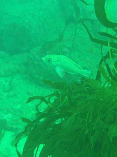



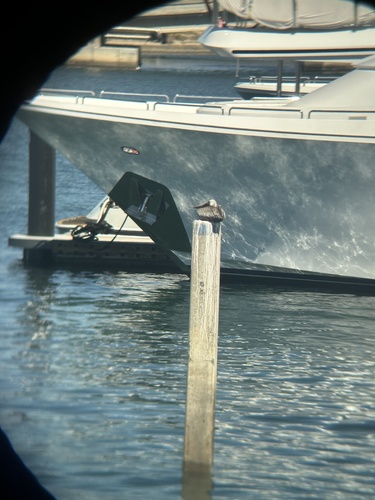
Research-grade observations from iNaturalist (within ~15 mi).
Nearest stream gauge
Live readings from USGS NWIS · measured 2026-06-28 05:00 UTC.
Events
Gallery
Geotagged photos within ~6 miles of San Diego, from Wikimedia Commons contributors.
.jpg) 0.3 mi
0.3 mi 0.4 mi
 0.4 mi
 0.5 mi
.jpg) 0.7 mi
0.7 mi 0.7 mi
 0.7 mi
 0.7 mi
 0.8 mi
 0.8 mi
 0.8 mi
 0.8 mi
 0.8 mi
 0.8 mi
 0.8 mi
 0.8 mi
 0.8 mi
 0.8 mi
 0.8 mi
 0.8 mi
 0.8 mi
 0.8 mi
 0.8 mi
 0.8 mi
Photos via Wikimedia Commons — see each image page for license & attribution.
Sources
- • Wikipedia
- • US Census Bureau (ACS 5-year estimates)
- • Open-Meteo (ERA5 reanalysis)
- • NOAA National Weather Service
- • Wikimedia Commons
- • Wikidata
- • Open-Meteo Air Quality (CAMS)
- • USGS Earthquake Catalog (global feed)
- • USGS NWIS (water data)
- • NCES via Urban Institute Education Data Portal
- • GBIF (Global Biodiversity Information Facility)
- • iNaturalist
- • CDC PLACES
- • Open-Elevation
- • Open-Meteo / sunrise-sunset.org
- • Wikipedia Pageviews API
- • Open Library
- • NASA EONET