Lazio · the dying town
Civita di Bagnoregio: The Italian Village Slowly Falling Off Its Own Cliff
An Etruscan village perched on a tower of crumbling tuff, reached only by a long footbridge. Locals have called it 'la città che muore' — the dying town — for nearly five hundred years.

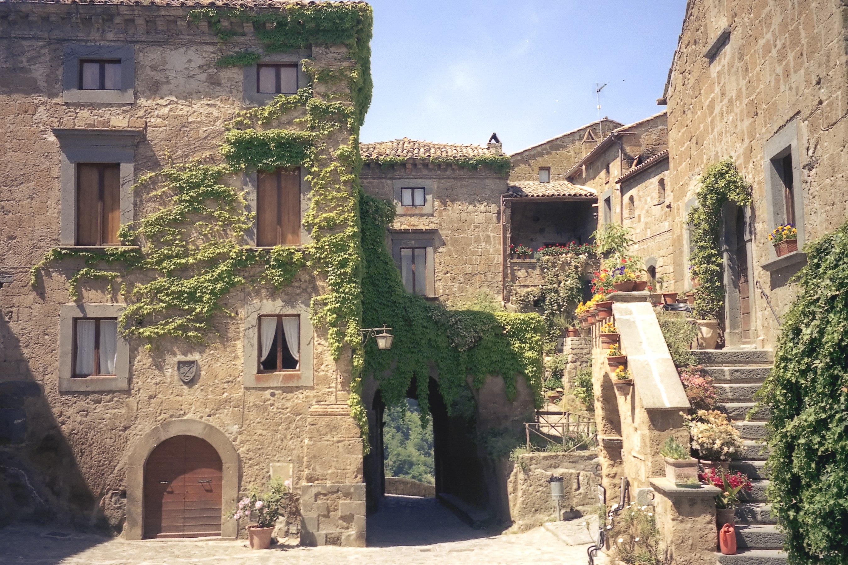
Civita di Bagnoregio is a tiny medieval village stranded on a pinnacle of volcanic tuff in northern Lazio, about two hours north of Rome. It has stone houses, a Romanesque church, terraced gardens — and roughly a dozen permanent residents. The village is reached only by a long pedestrian footbridge, and the cliff it sits on is, very slowly and very visibly, falling apart.
An Etruscan town built on the wrong rock
The site was settled by the Etruscans roughly 2,500 years ago. They chose the high tuff plateau for the same reason every later occupant did: it was defensible. The volcanic tuff is easy to carve — most of the cellars and many of the lower rooms in the village are Etruscan in origin — but it is also extremely soft. Underneath it sits a layer of marine clay, which slowly slides downhill when wet.
For centuries the village was the larger settlement; Bagnoregio, the modern town next door, was the suburb. Then a series of earthquakes — especially one in 1695 — collapsed entire neighbourhoods of Civita and severed its land bridge. People moved out. The phrase "la città che muore" ("the dying town") was coined by the local writer Bonaventura Tecchi in the early 20th century, but the underlying erosion has been going on far longer.
The footbridge and the entry ticket
The original donkey path between Bagnoregio and Civita was finally lost to a landslide in 1922. After decades with only a precarious wooden walkway, the current 300-metre reinforced-concrete footbridge was built in 1965. It is the only way in or out — no cars, no motorbikes, only pedestrians.
Mass tourism arrived in the 2010s, when Civita became a fixture on photo-led travel guides. The comune of Bagnoregio responded in 2013 by introducing an entry ticket — a few euros per visitor — that funds maintenance of the bridge, the cliff-face stabilisation works, and restoration inside the village itself. Annual visitor numbers now run close to a million.
Can it be saved?
Italian geologists have been studying the cliff actively since the 1980s. Every few years a chunk visibly detaches — most spectacularly in 2014, when a long section of the western wall sheared off. Drainage works, slope monitoring, and grouting of cracks have all bought the village time, but no engineer claims they can stop the underlying clay creep indefinitely. The optimistic estimates put another two or three centuries of life on the pinnacle; the pessimistic ones, considerably less.
Fun facts
- The village has roughly a dozen full-time residents in winter; in summer that figure swells with shopkeepers, restaurateurs and the visitors themselves.
- St Bonaventure, the 13th-century Franciscan theologian, was born in Civita (or in the older town of Bagnoregio, depending on the source).
- Many of the village's wine cellars are carved into the original Etruscan rooms beneath the buildings.
- Civita has been a candidate for UNESCO World Heritage status since 2006 but has not yet been inscribed.
Gallery

_-_agosto_2019.jpg)

Sources
Other interesting places
View all →


Featured lists
View all lists →


Keep exploring
See Civita di Bagnoregio on the map
Terralocate is a place encyclopedia covering thousands of towns worldwide. Open Civita di Bagnoregio's page for coordinates, population, nearby places, and an interactive map — or jump into the rest of Italy.
Compare cities, side by side
Choose any 2 cities →


Text on this page is original Terralocate editorial. Background facts compiled from the public sources listed above. Images via Wikimedia Commons under their respective licenses (typically CC BY-SA or public domain).